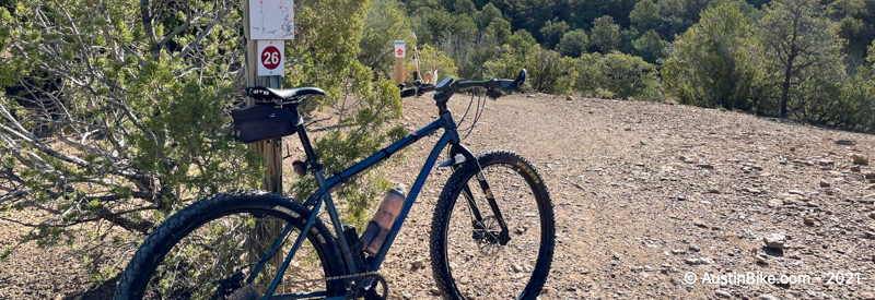
Located just north and east of Santa Fe, it is a relatively easy "ride to the ride" destination. There are three different sections and plenty of trail to hit. Everything from rocky and chunky to chunky and rocky. Great signage and well maintained for both hikers and bikers.
Location: Santa Fe, NM
Directions: There are multiple trailheads and even a connection from the Santa Fe Ski Area if you want to take the shuttle bus and avoid the climb. I took Upper Canyon Road, just past the Cerro Gordo trailhead. Take a right up a steep dirt road. There is a single track that takes off to the left about 100 feet up the road. After that the trail is well marked, with maps at every junction.
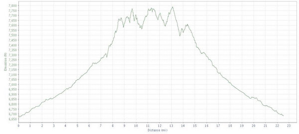
Technical Level: Medium to high. Generally speaking the trails are not overly technical, but there is a good amount of difficulty due to the sharpness of some of the turns and overall rocky nature.
Trails: Short sharp climbs, rocky and chunky surface. Lots of twisty singletrack with a a rocky base. Desert-like conditions.