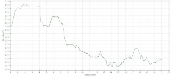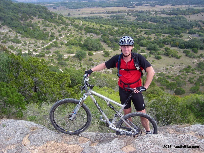
I hope you like to climb. Up steep hills. With babyheads. Don't let anyone fool you into thinking that this is "all jeep trails...", this place is as technical as any. The trails are well marked, but it is easy to take a wrong turn, so make sure that you get a map. With the huge number of trails out here, there is definitely a full day's worth of riding, so come on out for a day of fun. Sure it's a long way from Austin, but you'll never forget it.
Also, watch for the yucca plants (check the pictures below.) After an afternoon of riding my shins were completely ripped up and inflamed.
Location: Bandera, TX
Directions: Take I-35 south to Texas 46; head west until it dead ends into 16. Take 16 to Bandera. From Bandera, travel south on State Highway 173, go across the Medina River and continue for approximately 1/4 mile to State Highway 1077, turn right and go 10 miles on Ranch Road 1077 to end of the black top. Continue on the caliche road and follow the park signs to the park headquarters.
Technical Level: A little of everything, from low to medium to highly technical
For a good trail route, here are Carlos' directions:
ride up the road from the bottle opener, climb 6 and when it meets 5A, take a right and then ride the 5A loop that's got a scenic overlook incon on the map. it'll bring you right back to the intersection of 6 and 5A. from that intersection, get back on 6 and keep going until it turns into double track. ride all of the 6 portion that's double track (only about .7 of a mile if i remember correctly) until you get the intersection of 6 and 5C. hang a right onto 5C and ride 5C all the way to 1. then a right onto 1 and ride 1 until you get to 6. left on 6. and you can take 6, which will be the long climb you did at the begining in reverse) all the way back to the parking area.
the physical markers are usually easy to spot but if you miss a trail you'll know it....'cause you'll end up way the hell out somewhere at the other end of the park. hehehe
from the parking area...if you want to mellow the ride out.....take 8 all the way out and use 8A to get back. you'll see that loop on the map. there is a STUPID rocky descent on 8 that's a hell of a lot of fun to try and stay on your choosen line....most of the time you have to ride what you're given....
if you want to get sketchy...ride from the bottle opener...go up the road to the cattle guard and take 3 (the entrance just before the cattle guard) to 3A and hang a left where 3A meets 3 again. use 3A to get to 4A, which will get you to another scenic overlook where you can then turn around and disco a few downhills. the descent is 4A to 4...ride 4 all the way to 5. hang a left onto 5 and 5 will get you back onto the road. hang a right onto the road and it'll take you back to the bottle opener shaped parking area.