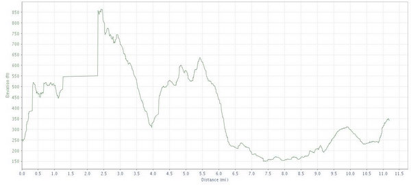
Most of you probably won't have an opportunity to catch a ride at Surisan, but if you do, it is one that you will not soon forget. Riding here is like nothing in central Texas, the closest you'll find is climbing like Government Canyon, yet significantly longer (mostly fire roads). Steep downhills similar to Cameron Park with technical rocky sections like City Park
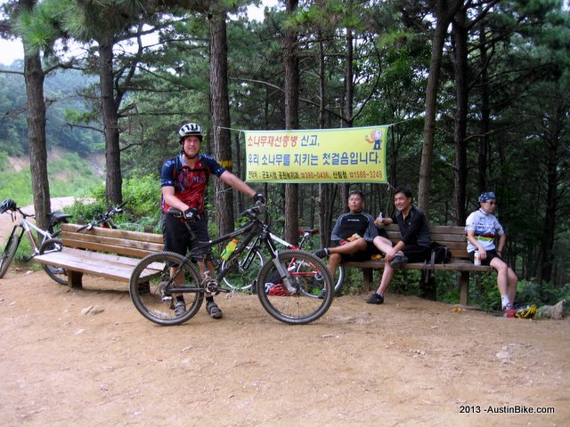
If you are coming out here, join the Yahoo group for MTB Korea - they're great folks who can hook you up with local rides. Seoul is littered with bike trails all around on the outskirts and probably 100+ miles of government-sponsored bike trails all around the city.
The climate in Seoul is a cross of Austin's heat and Houston's humidity. Hydrate well or you will be very sorry.
Location: Surisan, South of Seoul
Directions: (From the Filthy Freeriders site): Driving access is either by taking 1 south to 50 then west to the exit serving highway 47 (then look at the map), or cross Banpo bridge headed south, go through the tunnel under Umyeonsan, follow highway 312 to 100 headed west and then get off at the Sanbon exit. Drive through Sanbon headed generally south, then west following signs to get to highway 47 and/or expressway 50. Again, look at the map.
Technical Level: Medium to high. There are a few technical sections that I walked. The aerobic workout is pretty good with the climbing. This is a country of mountains.